BACKGROUND
Wan Chai Development Phase II Study
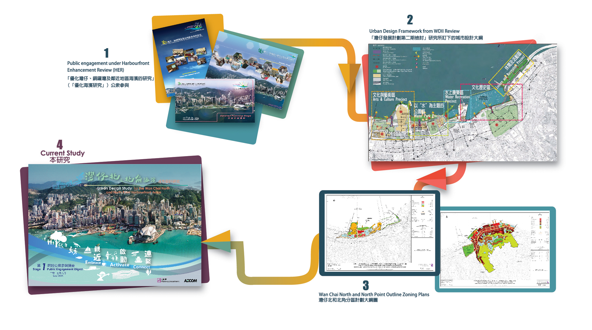
The Wan Chai Development Phase II Study (WDII) completed in 2002 recommended further reclamation of land along the Wan Chai North and North Point coastline for the construction of the Central-Wan Chai Bypass (CWB). In the light of the Court of Final Appeal’s judgment on the reclamation in Victoria Harbour under the “Protection of the Harbour Ordinance” in 2004, the Town Planning Board requested for a review on the WDII proposals to minimize the reclamation. In association with the review, an extensive and in-depth 3-stage public engagement, namely, the “Harbourfront Enhancement Review – Wan Chai, Causeway Bay and Adjoining Areas” (HER) was held. The WDII Review was subsequently completed in 2007. Five character precincts were proposed. The landuse proposals, with the newly reclaimed area mainly planned for open space, leisure and recreational uses as well as commercial/retail uses in support of the waterfront activities, have been incorporated into the relevant statutory Outline Zoning Plans.
Public engagement under Harbourfront Enhancement Review (HER).
Overall Context
Land uses along the Victoria harbourfront have evolved over the years to tie in with the changing circumstances of the harbour and the hinterland. Besides Central as the core business district and Tsim Sha Tsui functions mainly as a tourism node, the Wan Chai area, plays the role of an exhibition and commercial hub. With the proposed new rail lines (Shatin to Central Link (SCL) and North Island Line (NIL)) serving the waterfront, and additional offices and commercial developments in Wan Chai and Admiralty, the new reclaimed land should capture these opportunities and enhance the connectivity with the hinterland, while providing leisure/ recreation activities for public enjoyment. Equally, the water space in the Ex-Public Cargo Working Area, the Causeway Bay Typhoon Shelter and the planned landing steps, will provide opportunity to re-define the water use as a unique feature of the Victoria Harbour.

Overall context of Victoria Harbour.
Legacy of Wan Chai and North Point Shoreline
The Wan Chai and North Point areas had witnessed the long history of Hong Kong’s development. The evolution of our shoreline through reclamation over the past centuries, the Causeway Bay Typhoon Shelter with the Floating Tin Hau Temple, the fishing boat communities and floating restaurants, the Noon-Day Gun, the Kellett Island, the Royal Hong Kong Yacht Club, the ex-Public Cargo Working Area as well as the ex-A-King Shipyard site as historic icons to the maritime industries, all tell their own legacy and the unique stories of the local areas.
The original shoreline was located at Queen's Road East. The reclamations took place in late 1800s and early 1900s created new land to relieve the densely populated inner city and to construct vehicular arterials (i.e. Hennessy Road and Johnston Road). The reclamation in the 1950s and 1980s pushed the shoreline to Gloucester Road and Island Eastern Corridor. The Wan Chai development in the 1990s shaped the shoreline of today. However, functional requirements had long dictated the harbourfront. While traffic flow had been improved, accessibility to the water edge was constrained.

Evolution of Wan Chai and North Point Shoreline